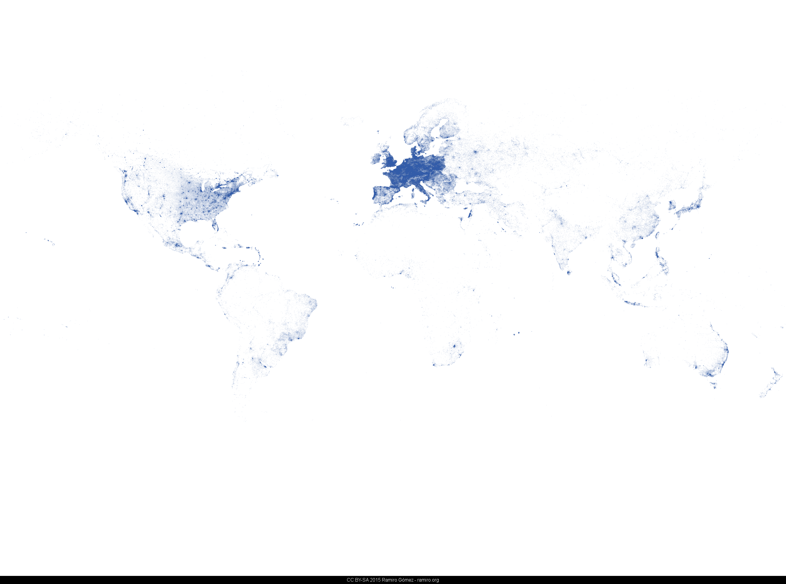
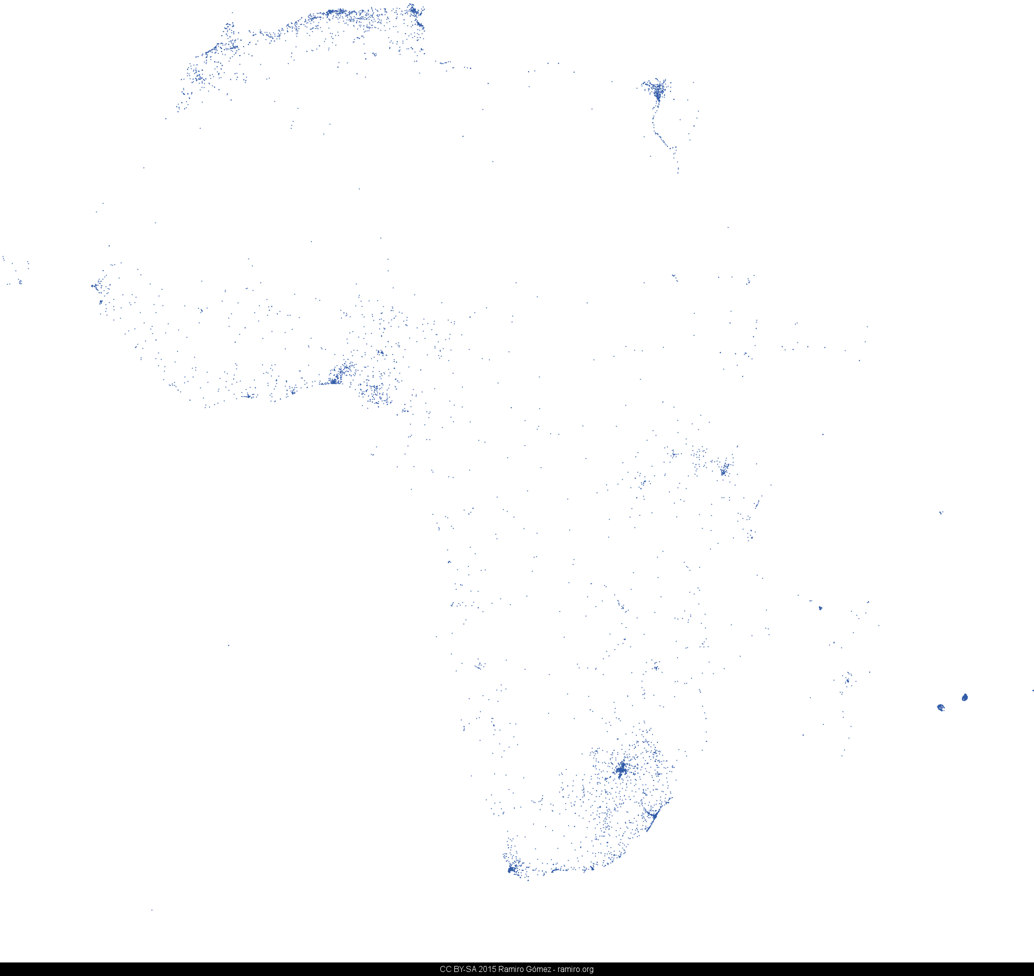
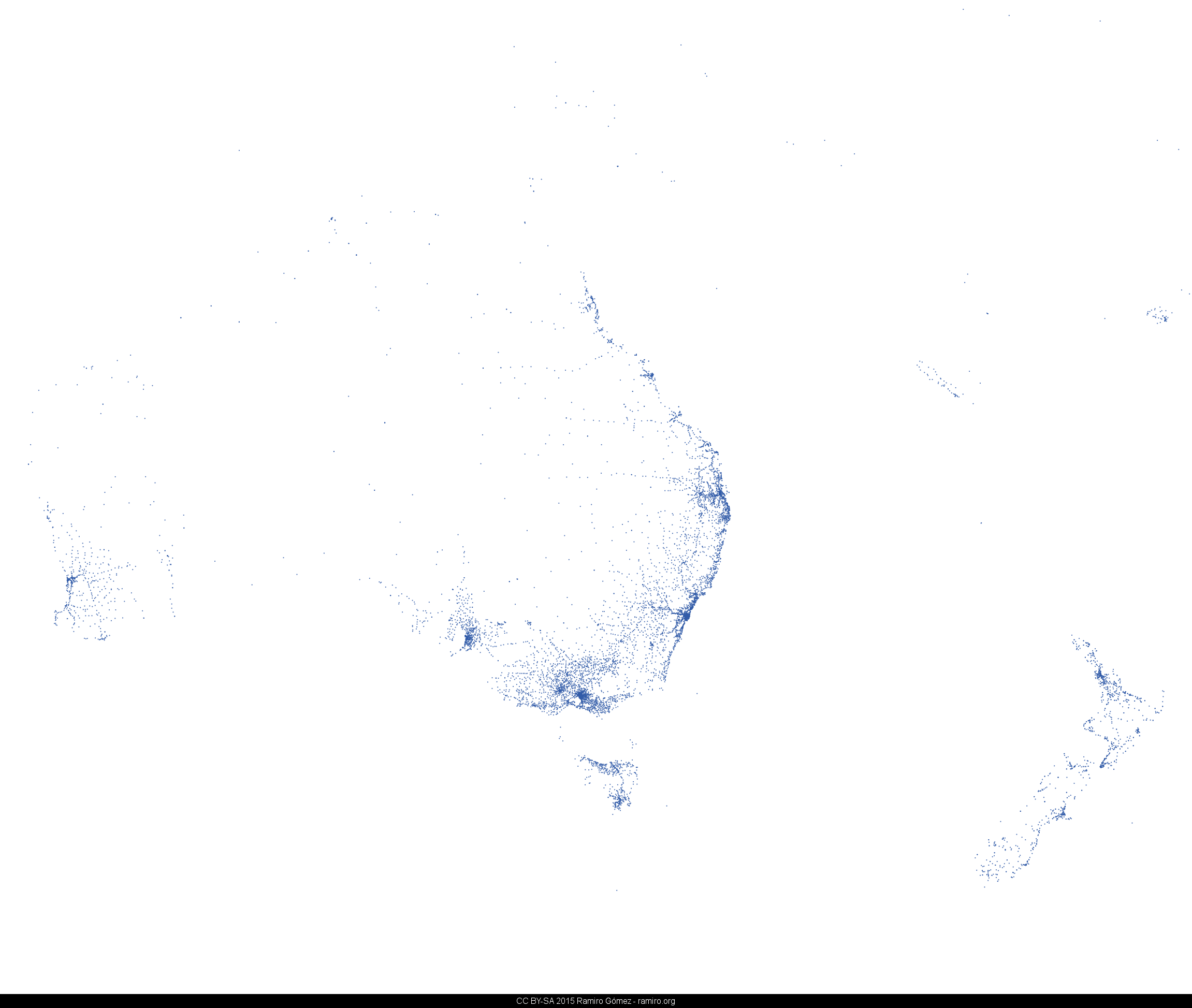
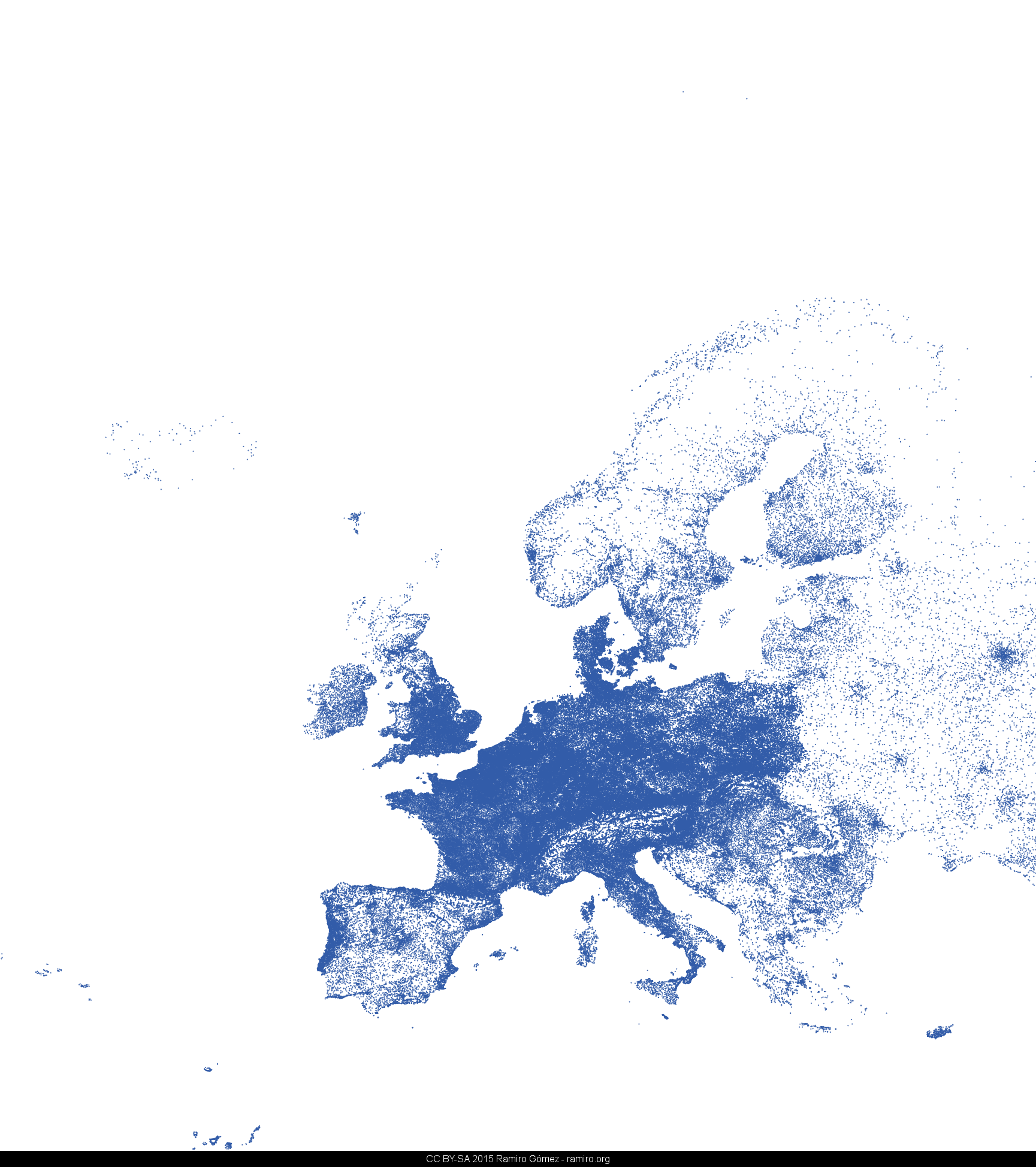
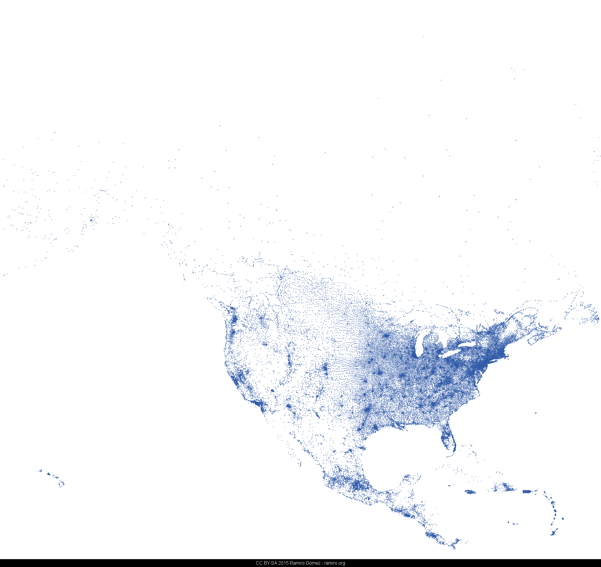
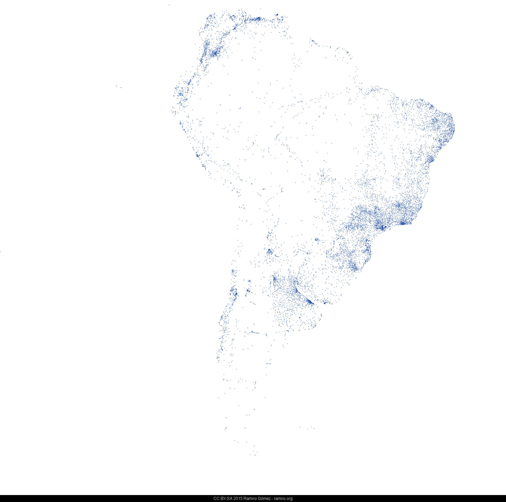
This is a collection of world and continent maps drawn from 419,433 IP locations. Each point on a map corresponds to a single record in the dataset.
The maps were created with the Matplotlib Basemap Toolkit using the Miller Cylindrical projection. You find the Python scripts for creating the images as well as some experimental stuff in the ip-location-maps GitHub repo.
The bounding boxes and centroids for the continent maps are based on information available from flickr places. I partly adjusted the locations to reduce the amount of whitespace and in case of Australia/Oceania to show Australia, New Zealand and New Guinea.
The idea to draw maps based on IP location data was inspired by projects like Foursquare's 500 million and Twitter's geography of Tweets maps. The IP location data used to draw them is provided by MaxMind and available in the GeoLite City dataset.
Published on June 11, 2013 (updated on November 18, 2020) by Ramiro Gómez (@yaph). To be informed of new posts, subscribe to the RSS feed.
Tags: map, ip-locations, matplotlib, graphics.
Check out the source code used to process the data and create the visualizations.
Code Repository